File:Elev Temp Precip maps Figure.png
Jump to navigation
Jump to search

Size of this preview: 800 × 360 pixels. Other resolutions: 320 × 144 pixels | 2,446 × 1,102 pixels.
Original file (2,446 × 1,102 pixels, file size: 3.16 MB, MIME type: image/png)
Summary
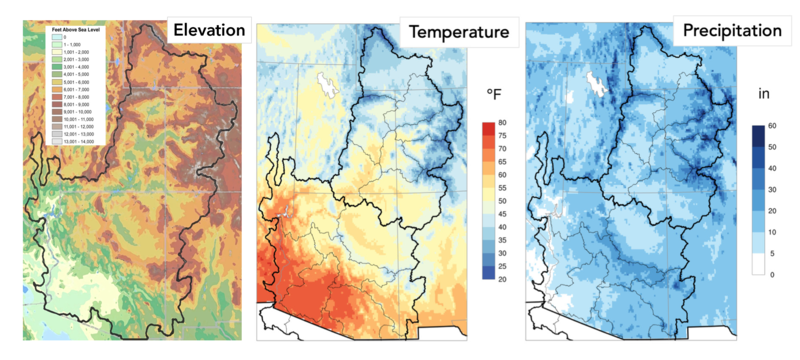
Colorado River Basin maps of elevation, average annual temperature, and annual precipitation.
File history
Click on a date/time to view the file as it appeared at that time.
| Date/Time | Thumbnail | Dimensions | User | Comment | |
|---|---|---|---|---|---|
| current | 16:47, 3 May 2021 | | 2,446 × 1,102 (3.16 MB) | JeffreyJLukas (talk | contribs) | Colorado River Basin maps of elevation, average annual temperature, and annual precipitation. |
You cannot overwrite this file.
File usage
The following page uses this file: